Arson Rashidmardani · Graduate urban / transport planner

Urban planning, design and transport shaped by evidence, access and everyday experience.

I work across spatial analysis, policy, urban design and transport to shape well-connected growth, safer movement and places that can be delivered across Tāmaki Makaurau.

Bachelor of Urban Planning (Honours)University of AucklandCompleting December 2026
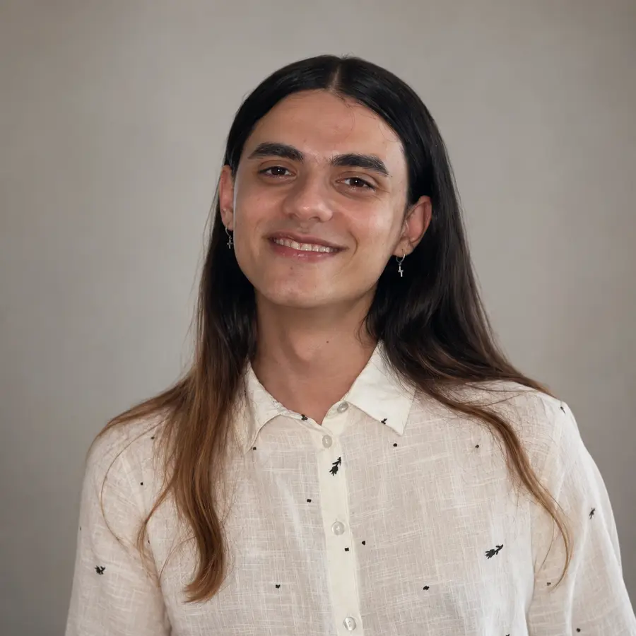
Portrait of Arson Rashidmardani
Based in
Auckland, New Zealand
Availability
2027 graduate roles
Work status
New Zealand citizen

I am interested in the point where planning becomes tangible.

A safer crossing, a legible network, a public space people choose to use, or a delivery sequence that can actually happen. I use field audits, GIS, policy analysis and engagement to make the problem legible, compare options and translate findings into spatial or policy responses.

6.91 / 9
current GPA
Planning + design
place and movement focus
GIS + policy + design
integrated toolkit

Work located in the places it investigates.

Select a location to see the planning question, method, contribution and proposal.

AF Thomas Park, Wairau Valley2025
Hono Wai project preview

Transit-supportive masterplanning

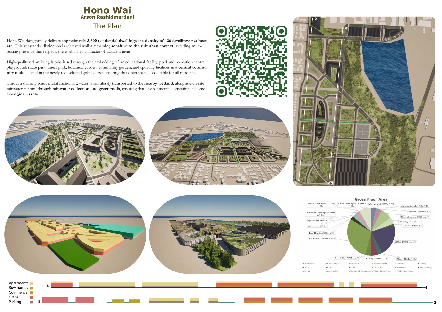
Hono Wai

An individual blue-green masterplan for approximately 3,300 proposed dwellings, structured around a community node, water-sensitive streets and access to Smales Farm station.

Methods
Site analysis, masterplanning and spatial testing
My role
Individual final masterplan
~3,300
proposed dwellings
126/ha
proposed density
Studio–3 bed
housing mix tested

Four projects spanning place, movement, land use and implementation.

These projects show how I investigate a place, develop options and translate analysis into spatial proposals and implementation steps.

Case study 01

Highland Park · East Auckland · 2026

Rewiring Highland Park: a phased low-carbon transport strategy

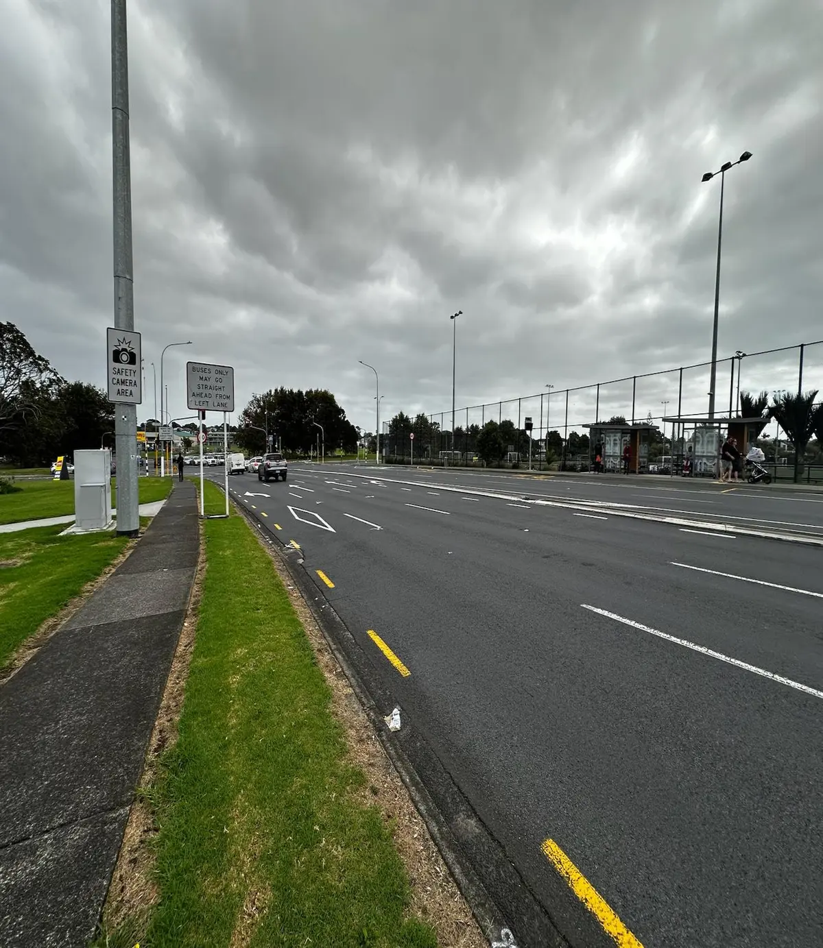
A safety and accessibility audit identified missing crossings, driveway conflicts and discontinuous walking and cycling routes. The strategy compares transport pathways before specifying immediate, medium-term and long-term network changes.

Project settingIndividual academic project
My contributionResearch, spatial analysis and strategy
2.9 MtCO₂e
2041 reduction in the walking-and-cycling scenario evaluated
30 km/h
proposed catchment-wide safer-speed treatment
0–5 / 5–15 / 15–30
proposed delivery horizons in years
  1. 01 · Evidence

    Audit safety and accessibility first

    Field and spatial analysis located missing crossings, high-risk desire lines, poor lighting and network discontinuities.

  2. 02 · Options

    Compare pathways and trade-offs

    Walking-and-cycling investment was compared with a technology-led pathway using sourced emissions scenarios, co-benefits, public acceptability and delivery risk.

  3. 03 · Proposal

    Connect quick wins to structural change

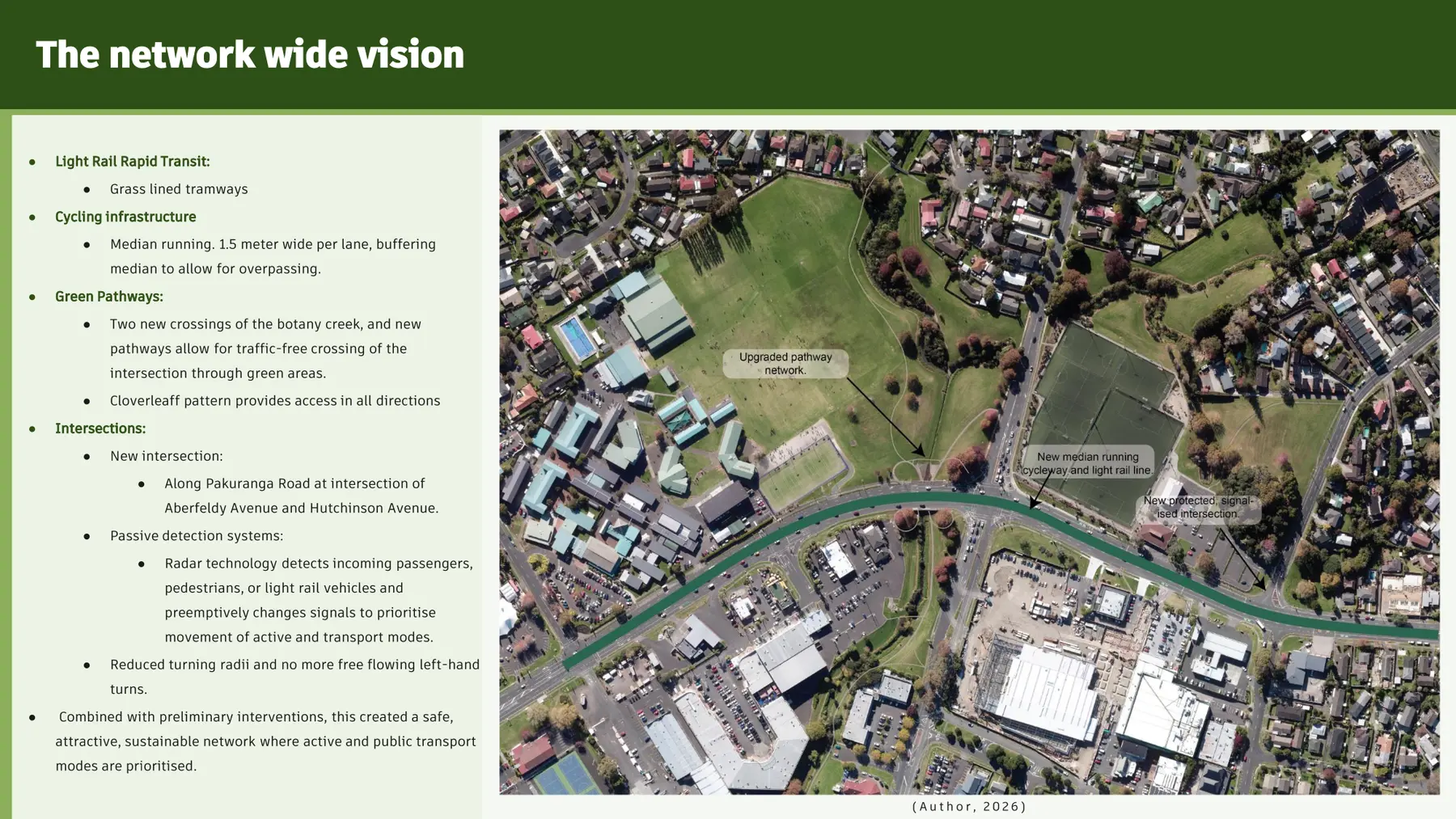
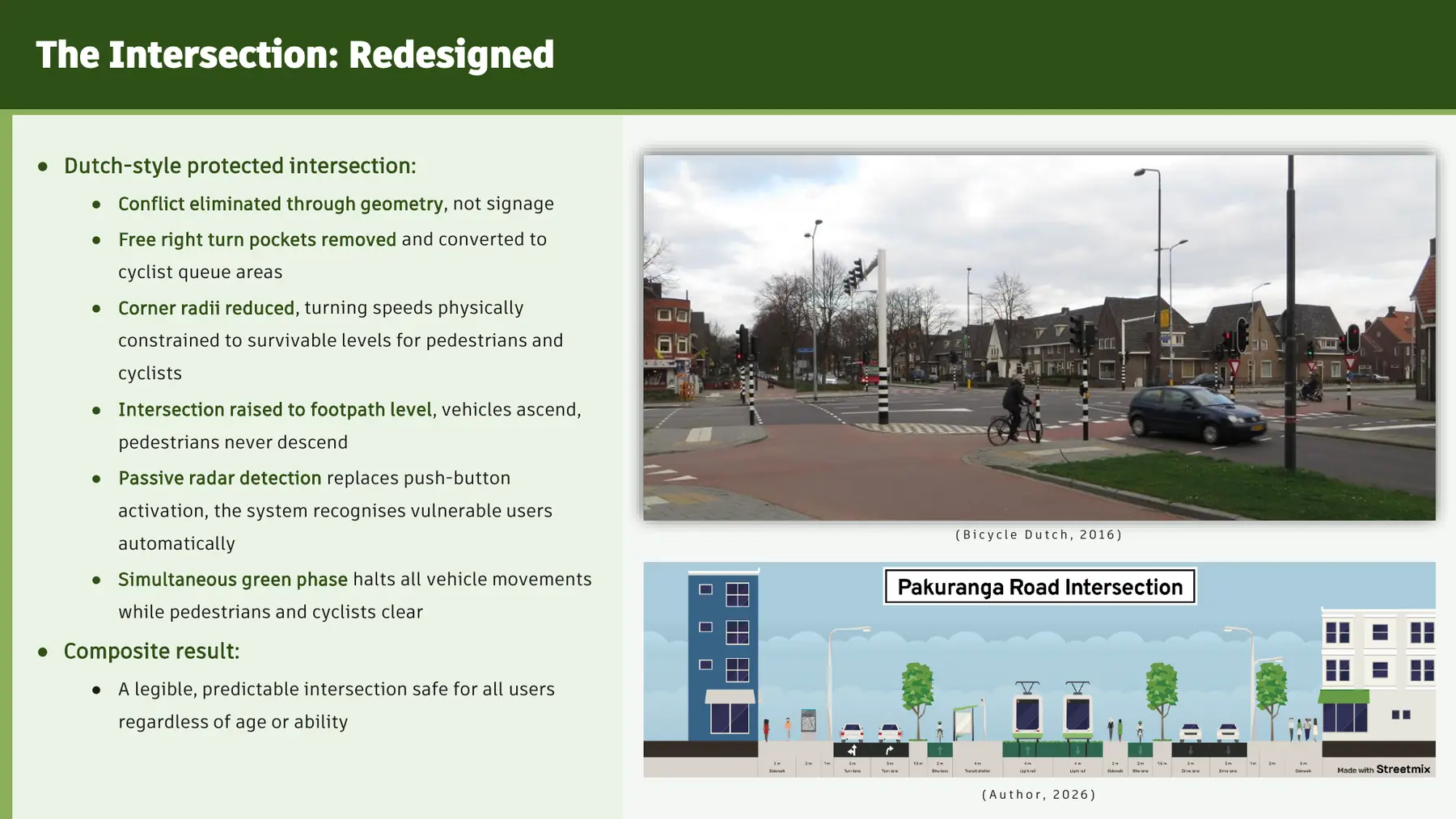
    Raised crossings, continuous footpaths and speed management build toward protected cycling, public-realm improvements and a median rapid-transit corridor.

Case study 02

High Street · Auckland City Centre · 2025

High Street: a pedestrian-priority framework with a delivery path

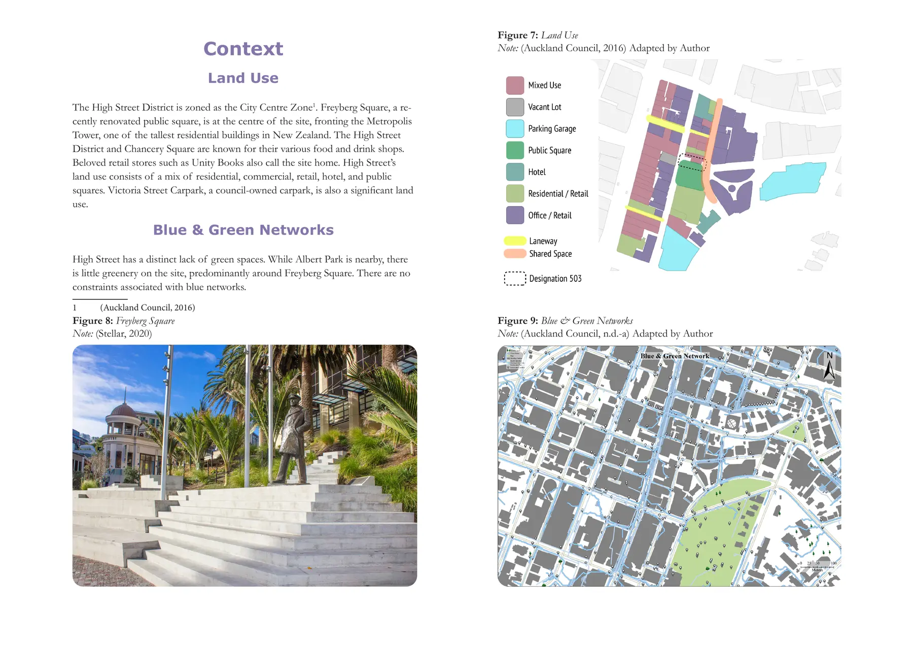
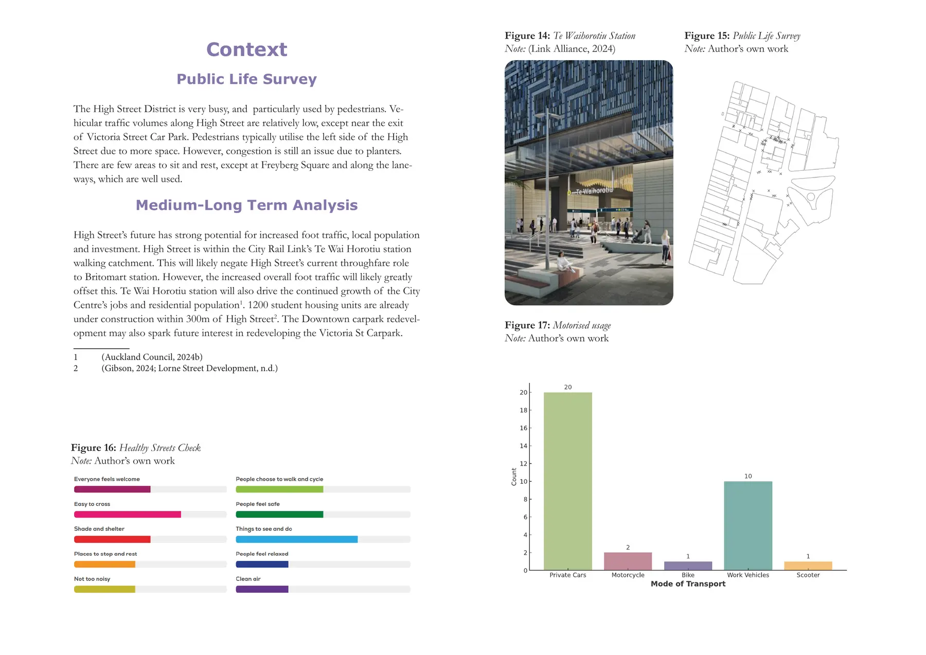
A walking-safety audit, public-life survey and movement analysis informed a tactical-to-permanent framework that prioritises pedestrians while retaining defined windows for servicing and access.

Project settingCollaborative studio project
My contributionFramework co-developed; individual analysis
2 × 30 min
proposed daily servicing windows with retractable bollards
3.6 m
proposed clear pedestrian path beside the carriageway
25
proposed interventions linked to timing and stakeholders
  1. 01 · Evidence

    Use street life to define the brief

    Counts, movement mapping and observations identified pedestrian congestion, limited seating and low traffic volumes alongside genuine servicing needs.

  2. 02 · Design

    Balance pedestrian priority with servicing

    Retractable bollards, an extended planted boardwalk, raised crossings and parklets create a pedestrian-first street with two daily servicing windows.

  3. 03 · Delivery

    Link interventions to responsibility

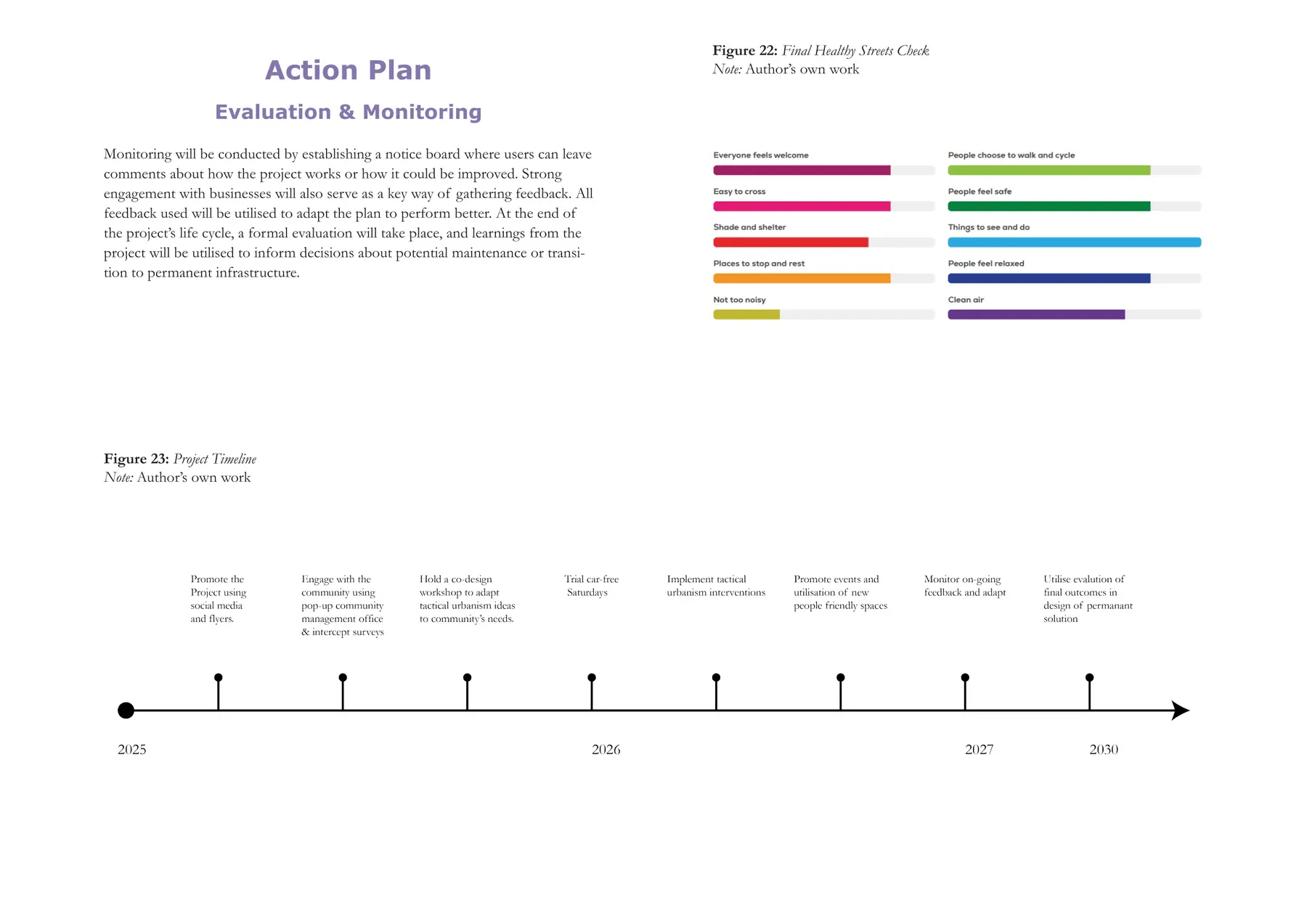
    The group action plan assigns indicative timing, stakeholders, funding status and cost bands rather than presenting a design without an implementation route.

Case study 03

Onehunga · Auckland isthmus · 2025

Onehunga: integrating growth, active travel, rail and water

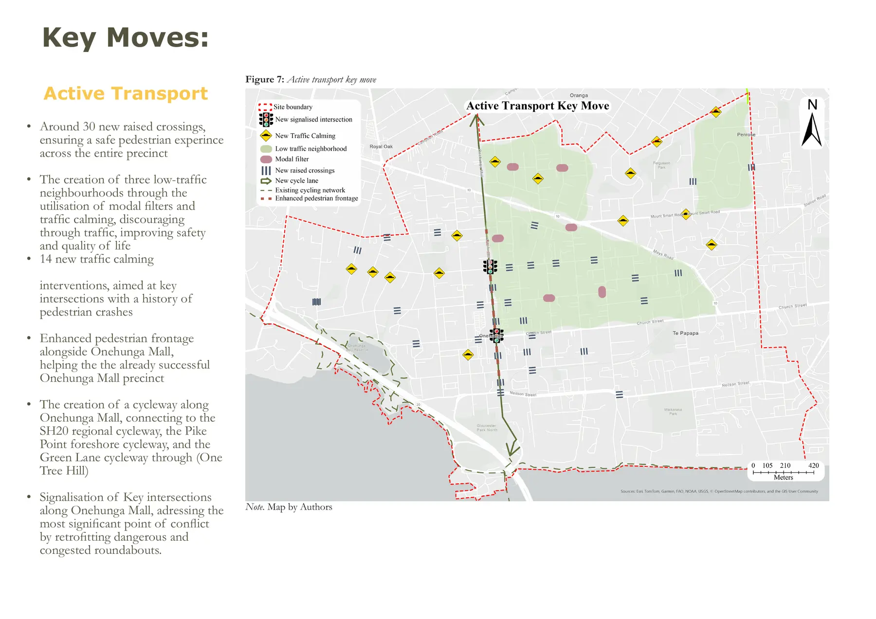
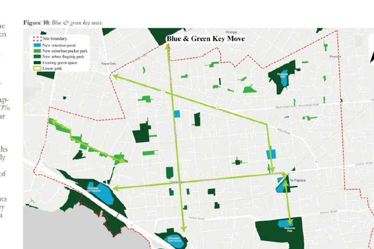
The group framework treats development capacity, flooding, public space and transport as one system. My individual follow-on report developed the blue-green network key move and its delivery implications.

Project settingCollaborative studio + individual follow-on
My contributionFramework co-developed; blue-green key move developed individually
96,000 m³
approximate proposed stormwater retention capacity
8 km
proposed linear-park network
450 m
proposed passing loop supporting a 12–15 minute rail pattern
  1. 01 · Integrate

    Make infrastructure perform several functions

    Linear parks are proposed to convey water, close active-travel gaps, connect growth areas and improve access to open space.

  2. 02 · Quantify

    State the scale of the proposal

    The framework records approximate retention volume, network length, green-space area and affected properties so that delivery consequences remain visible.

  3. 03 · Sequence

    Pair growth with transport service change

    Raised crossings, cycle connections and a rail passing loop are staged alongside blue-green delivery and redevelopment areas.

Case study 04

AF Thomas Park · Wairau Valley · 2025

Hono Wai: a transit-supportive blue-green masterplan

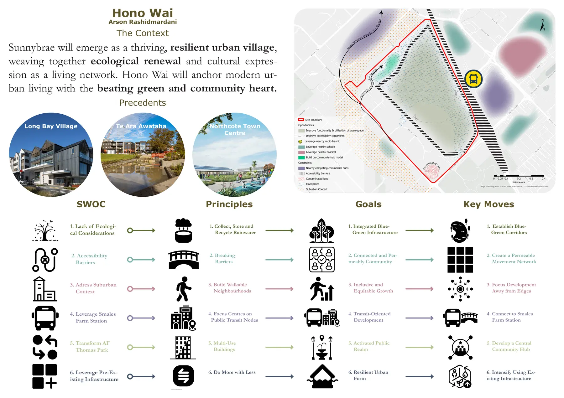
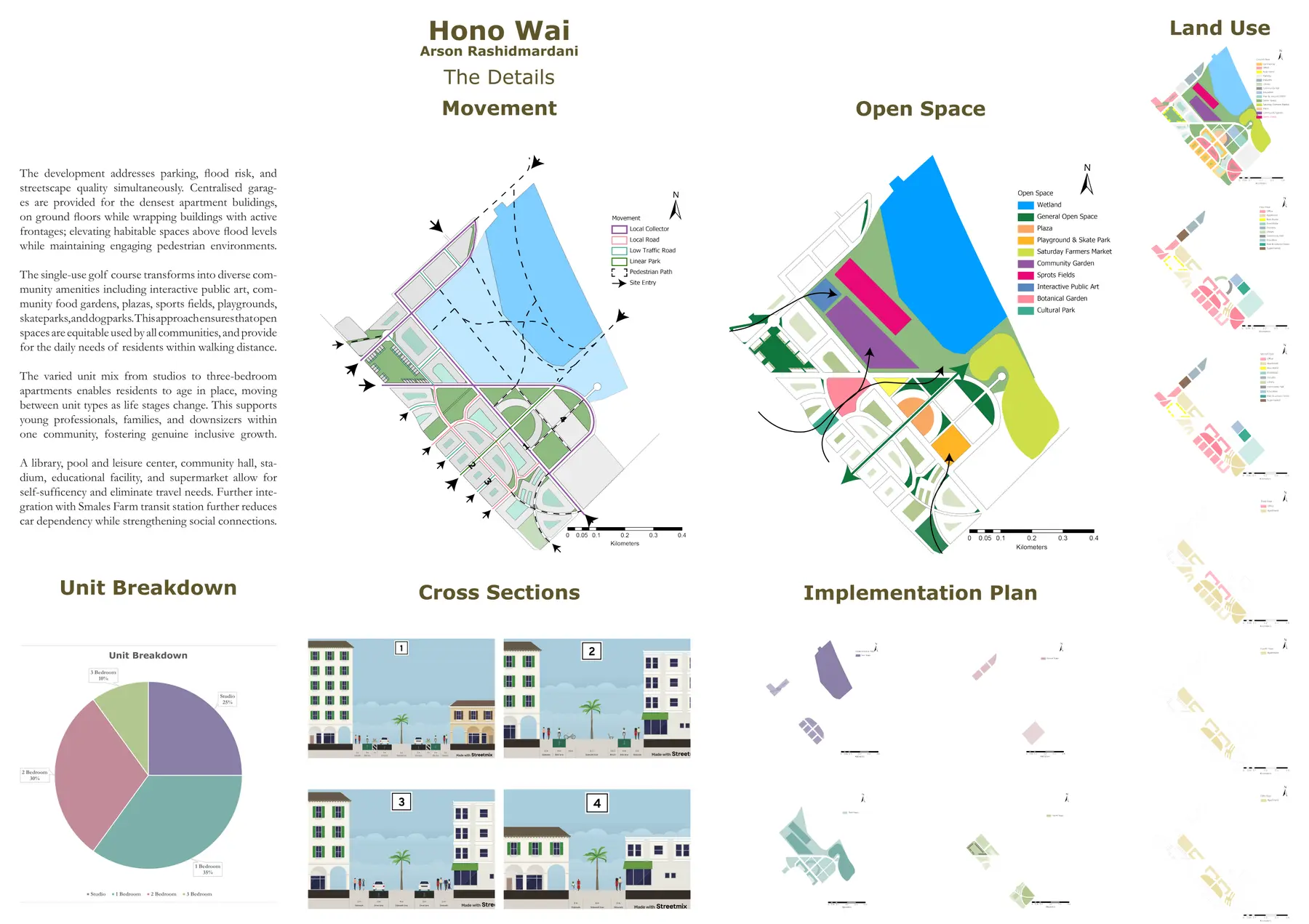
The individual final masterplan accommodates approximately 3,300 proposed dwellings at 126 dwellings per hectare while using water-sensitive streets, a central community node and direct local movement connections to structure the neighbourhood.

Project settingIndividual studio project
My contributionResearch, masterplanning and visual communication
~3,300
homes accommodated in the masterplan
126/ha
proposed residential density
Studio–3 bed
housing mix tested
  1. 01 · Structure

    Use landscape as primary infrastructure

    Rainwater collection, green roofs, multifunctional streets and wetland connections respond to flood risk while shaping the public realm.

  2. 02 · Connect

    Reduce barriers to short trips

    A permeable movement network links homes to community facilities, open space and Smales Farm station.

  3. 03 · Test

    Move between systems and human scale

    Plans, sections, massing and ground-level views test whether the density and network logic produce a credible everyday environment.

Hono Wai project film

A spatial idea, experienced in motion.

The walkthrough moves from the masterplan into the proposed streets, community node and blue-green public realm, testing how density might feel at eye level.

60-second silent walkthrough

The questions I return to.

Select a topic to see the practical test I apply and the project where it is visible.

What it means in practice

Urban + transport integration

Treat movement, land use, public realm and climate as one place system.
Applied in

The Onehunga framework pairs growth staging with active travel, rail service and blue-green infrastructure.

Open related work

Clear communication and practical process improvement.

Retail leadership has developed the operational habits I bring to planning: understand the user, document the process, communicate decisions clearly and improve systems without losing sight of day-to-day delivery.

Mobie · Newmarket

August 2022–present

Sales Assistant with senior-team responsibilities

  • Created a practical staff training manual to standardise onboarding and routine procedures.
  • Developed AI-assisted improvements to product-label creation and cash-up workflows.
  • Support colleagues, resolve operational issues and communicate technical product information to a diverse customer base.
View full employment record in CV
Urban designMasterplanningArcGISPolicy analysisLand-use integrationTransport planningCommunity engagementClimate resilienceDevelopment feasibilityAdobe Creative Suite

Available for 2027 graduate opportunities

Planning and design for connected, inclusive and lower-carbon places.